

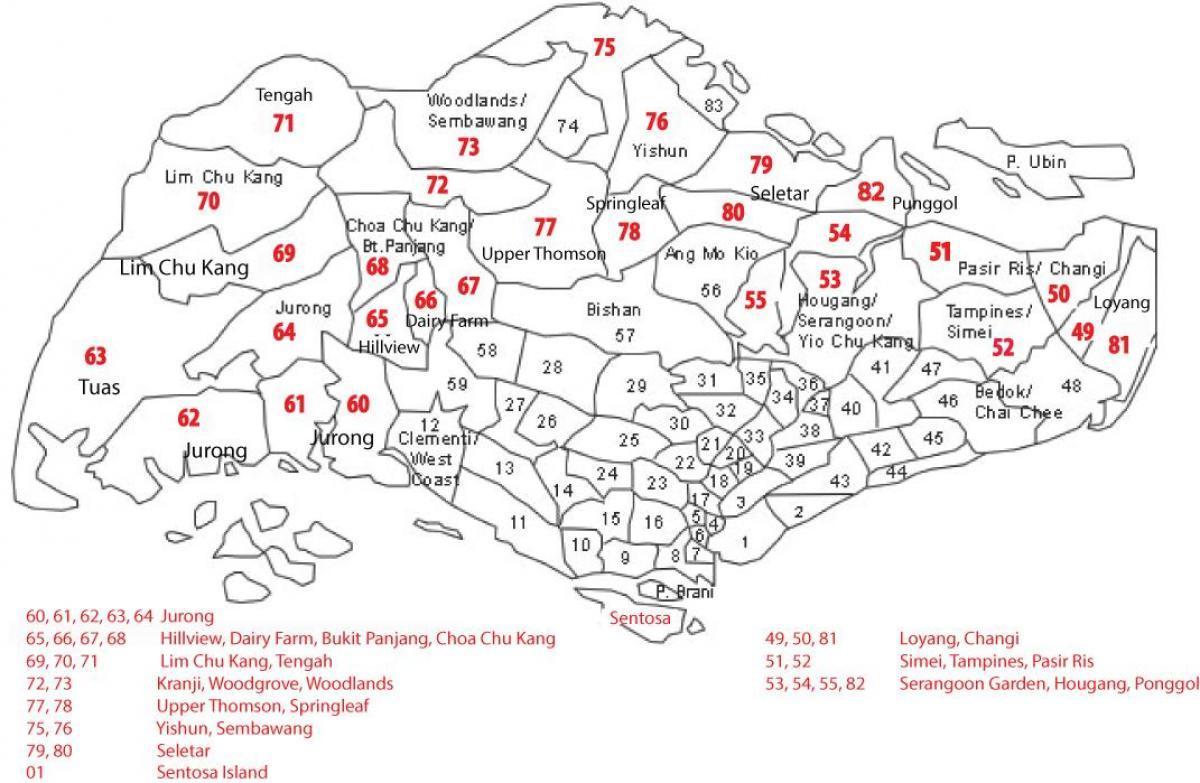
You can find on this page the Singapore zipcodes map to print and to download in PDF. The Singapore zip code map presents postal codes, address lookup and code list of Singapore in Singapore.

The Singapore postcodes map shows all the zip codes of Singapore. This zip code map of Singapore will allow you to easily find postal codes and address lookup of Singapore in Singapore. The Singapore postcode map is downloadable in PDF, printable and free.
Singapore was originally divided into 28 postal districts in 1950, with a number being allocated to each district, for example, the Orchard Road area was in District 9. On 1 September 1995, Singapore postcode was replaced by a six-digit system as its shown in Singapore postcodes map, in which every building was given its unique postcode, the first two digits of which represented the old sector, i.e. 23.
The 6-digit postcode is made up of the sector code and the delivery point. The sector is represented by the first two numbers of the Singapore postcode. The remaining four numbers define the delivery point within the sector. e.g. 24 is the sector code; 7964 is the delivery point, i.e. house or building as its mentioned in Singapore postcodes map. HDB residential blocks of Singapore with the same number in the same postal sector are differentiated by their postcodes as follows: e.g.
Singapore postcodes for private residential, commercial and industrial houses and buildings are assigned based on the alphabetical sequence of the street names in each sector. This means that the codes for a particular postal sector have been assigned first to houses and buildings located along street names beginning with ‘A, followed by ‘B’ and so on as you can see in Singapore postcodes map.